Thinking of Hiking the Grand Canyon Rim2Rim? Think again…. (Part 3 of 3)

Hiking down into the Grand Canyon is optional. Getting out of there is mandatory. A popular saying about the GC goes, “There’s no shuttle bus from the bottom to the top.” The only ways to get out of the Grand Canyon once you hike down is to: 1) walk out; 2) get carried up on a medical litter; or 3) get evacuated by helicopter. After nearly twelve hours of hiking 7 miles down from the South Rim and then hiking 7 exhausting miles across the canyon, Chief and I were faced with the above three options.

At Cottonwood Campground, we had already climbed about 1,500 feet on our hike up the North Kaibab Trail. There was still 6.5 miles in front of us with a grueling 4,200′ elevation gain to reach the North Rim. Chief continued to apologize for suggesting we could undertake the Rim2Rim hike in one day. The hike across the bottom of the canyon had taken its toll on our bodies as we dealt with the intense heat and increased elevation. Our legs felt as though they were already made of jelly and I was struggling with stomach pain for an unknown reason. Chief had major blisters on his feet but wouldn’t take off his shoes, as if avoiding the sight of several fluid-filled pox would make the pain more tolerable. I looked around at other hikers who were also struggling but who then took off up the trail with the same painful expression I’m sure we had. The air was so dry and hot I couldn’t even manage to express the tears I wanted to shed. It was 3:30 PM and Chief asked, “Do you want to try to spend the night at Cottonwood Campground or continue walking?” A major obstacle was that we had no permit or tent to stay the night since sleeping at the bottom of the Grand Canyon was never in the plan. We had reserved a lovely room at the North Rim Lodge months ago, but we began to doubt if we’d ever arrive. Would anyone find us at the bottom of the canyon if we couldn’t continue? Visions of hungry vultures came to mind as I imagined them picking away at our dead bodies. Anyhow, I could have easily ripped Chief a new one, but realized the intense guilt he already felt about bringing us here was probably punishment enough. We decided to continue walking, just to see if we could make it 1.4 miles to the next checkpoint at Manzanita. Our only hope was in a prayer that God have mercy on our situation and give to us the strength to walk out.

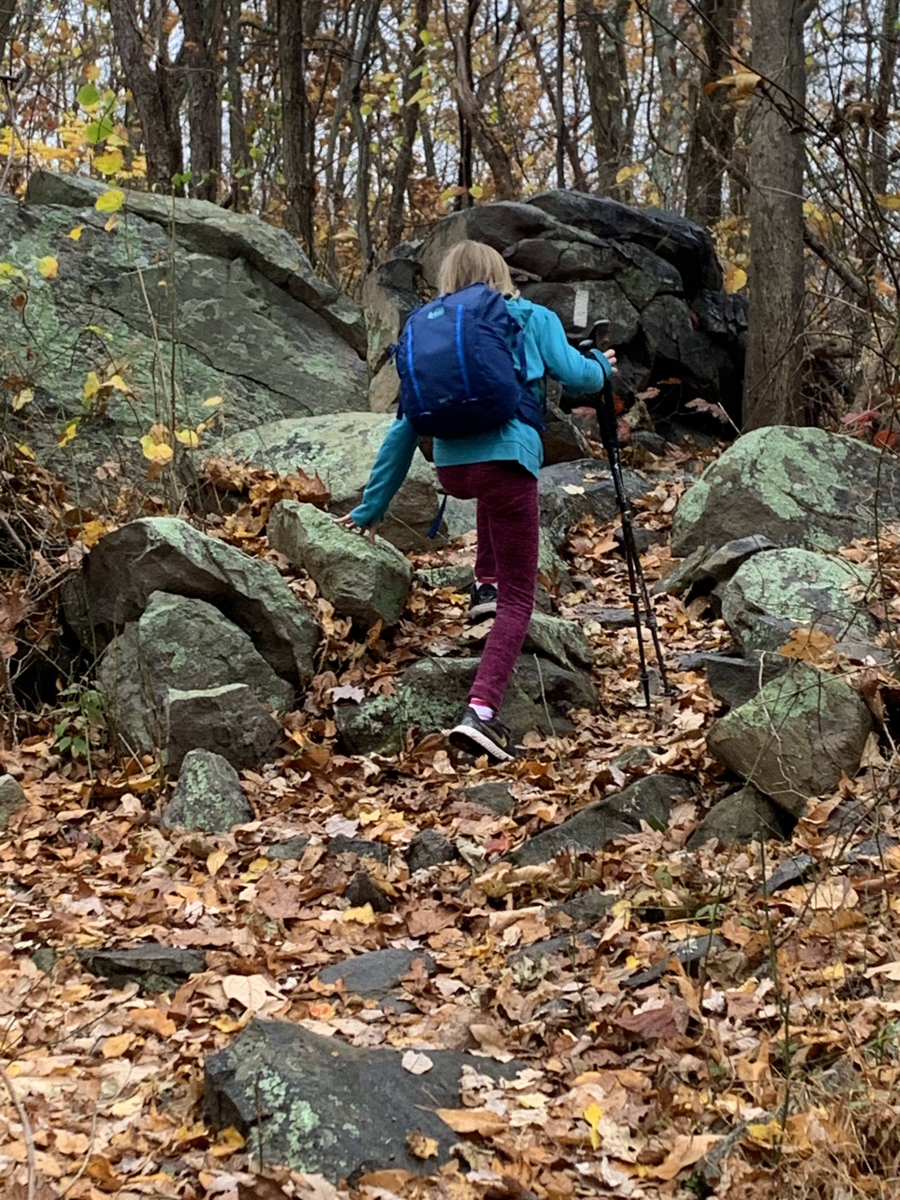
The hike to Manzanita was a 360-foot evaluation gain and we arrived by 4:30 PM. We stopped and briefly rested on a bench and filled our water bottles at the water pump, feeling somewhat successful in our arrival. The next section to Roaring Springs was going to be a steeper climb of 500′ in less than a mile. Our confidence was short-lived as the ascent was immediate and breath-taking; not because of the view rather due to the difficult climb and the high elevation. I stopped every 20-30 steps just to catch my breath. Chief patiently waited every time. Over an hour later, we finally caught sight of the beautiful waterfall at Roaring Springs. I wish we could have enjoyed it more, but we knew we had to keep moving our legs. There was only about three hours of daylight left with more than four miles of steep trail to reach the North Rim. We didn’t anticipate how slowly we would hike the next two miles as three hours passed quickly and the sun started to set. Another hiker caught up with us and we were surprised to see he was carrying a bicycle on his back! He silently passed us and then he effortlessly climbed a steep portion of the trail. Chief and I wondered a purpose for having a bike. Is he hiking Rim2Rim and planning to ride the bicycle back to the South Rim? Or is he taking the bicycle to the North Rim for another person? That mystery kept our minds occupied for a minute or two. Anyhow, we reached the Redwall Bridge as the sun was setting. The bridge crosses a deep gorge, which was several hundred feet down. We put on our headlamps and carefully stepped across the wooden planks of the bridge, staying in the direct middle since the metal siderails had openings large enough for an elephant to fall through. Chief said, “Don’t look down.” He didn’t say to hold my breath. I think that came naturally as we cautiously made each step. On the other side of the bridge, the trail narrowed even more and the steep gorge was frightening as we cautiously stayed toward the wall side. The canyon grew darker and darker as the sun disappeared toward the west. Any other day we would have appreciated the beautiful sunset and the colors on the canyon walls, but this hike was too exhausting and concern about the darkness settled in hard. Another Rim2Rim hiker passed us and told us we had about 2.5 miles to reach the North Rim trailhead. He said he was going to finish this hike and then hike back to the South Rim the next day. I commented under my breath that he was off his rocker (just my opinion). He quickly disappeared in the dark, but we watched the light from his headlamp go up and up the canyon ledge. We were unaware we had over 2,000′ yet to climb.

Chief told me to take the lead on the trail as he wanted to watch that I didn’t trip in the darkness and fall toward the edge (keep that tidbit in mind). The canyon was quiet and we could only see a few feet in front of us on the narrow ledges with the help of our headlamps. Every movement was a climb and I tried counting steps just to keep motivated as we navigated the switchbacks. The repetition of our steps were only interrupted with a brief stop to rest and breathe. We soon put our jackets back on as the temperature cooled in the night. Back to counting steps–1, 2, 3… Suddenly, I noticed movement four feet ahead on the trail with the light of my headlamp. It was a snake and I immediately looked at the tail and saw the rattler. I stopped and kept my headlamp light on it to access where it was headed. The snake was small, stopped briefly, then slithered toward the wall side of the trail. Chief said he would use his hiking stick to keep it away and told me to pass near the ledge as fast as I could. We both passed safely but soon came upon another obstacle. A rock slide had left good-sized boulders on the trail. At first, we couldn’t see where the trail went because in the darkness the path wasn’t clear. We climbed over the boulders and eventually found the trail free of fallen rocks. Just when I thought we could safely keep walking, I heard Chief shout my name and yell for help! Panicked, I looked back to see he was hanging over the ledge. I ran back and he said to grab his arm and pull him up. Thank God that there was a tree behind him which stopped him from falling any further over the ledge. Chief said that he had tripped over a rock and fell near the edge. Maybe he should have walked in the lead so I could catch him… Those dangers kept us hyper-vigilant and, most likely, awake as we continued the hike.

There is no cellular service in the Grand Canyon so we were surprised when my phone started to ding at a certain elevation. Several text messages came in all at once. Lots of people were wondering what happened to us. We didn’t want to reply to everyone as it was after midnight back east. We did get these messages from our daughter:

Daughter(10:20 PM our time): “Hey mom–just trying to see if you guys are alright?”

Daughter: “I text dad a few times but haven’t heard anything. Getting a little worried.”

Me: “We are still on trail unfortunately. About 1.5 miles left but slowly plugging. Sorry if this arrives late. Dad’s phone lost charge today.”

Daughter: “Only 1.5 left! You can do it! Thanks for texting. Let me know when you arrive, where you are staying. Love you guys!”

The words were encouraging but we weren’t sure we could even hike another mile and a half. It seemed like we were making very little progress. We arrived at the Supai Tunnel, an area where the rocks form a tunnel that leads to an open, flat grassy area. The area is filled with pine trees, although in the darkness I could only smell the sweet scent of pine. We sat down to rest and Chief got clean drinking water from the pump. Chief and I had another conversation about staying there and finishing the hike the next day. While resting, a group of three hikers from Tennessee and two hikers from Texas joined us. Like us, they were also attempting a Rim2Rim hike. And also like us, they were struggling physically and mentally. Everyone decided to keep hiking but it was at a snail’s pace. Walk a few steps, then rest. Walk then rest. We’d pass them then we’d stop. They passed us then they’d stop. That became the rhythm as we all moved slowly the next mile toward the North Kaibab trailhead. Rachel, one of the hikers from Tennessee was 21 years old and in good enough shape to hike ahead. I heard her jubilantly screaming that she made it to the North Rim trailhead. I knew we were close! At 12:30 AM, Chief and I somehow found a burst of energy and climbed the steps to reach the North Rim of the Grand Canyon at an elevation of 8,241′. The 21-mile hike from the South Rim to the North Rim took us 21 straight hours to complete–by far the most difficult hike we have ever attempted. And only by the grace of God it was completed.

EPILOGUE: Chief and I arrived at the Grand Canyon’s North Rim Lodge at 1:00 AM on May 25th. Rachel and her family had a car parked at the North Rim parking lot and gave us a ride to the Lodge, which saved us another mile walk. We did remember to text our daughter that we arrived. The desk clerk on duty checked us in and gave us the key to our room. A warm shower and comfortable bed were waiting for us. Though neither of us remember dropping into bed, Chief and I awoke later that morning and texted family and friends that we had safely completed the Rim2Rim hike. Their prayers and support kept us going! The dining room at the North Rim Lodge served an amazing breakfast buffet and, boy, did we eat our money’s worth! We had booked a shuttle to pick us up in the afternoon and drive us the five-hour trip back to the South Rim. It was dark when we arrived later that night back to our tent at Mather Campground–exhausted and sore. What we learned from this hike is that there is often purpose in the struggle. The path of life, like the hiking trail, is sometimes dark and unclear. Life can be treacherous and exhausting, but also beautiful and amazing. We walk and walk but sometimes it can seem like we aren’t getting anywhere. We think we know the way but we can’t always trust our own thoughts. The truth is the Lord is always with us. He never leaves us or forsakes us. He carries us when we can’t make the journey. He leads us when we are unsure. His forgiveness is complete, as ours should be to others. God loves us unconditionally–even when we make choices that aren’t totally right. God can make ALL things right. God is good all the time! Of that, we are sure.

Thinking of Hiking the Grand Canyon Rim2Rim? Think again…. (Part 2)

Preparing for a Grand Canyon Rim2Rim hike consists of physical, as well as mental training. Chief and I spent months walking in the Florida heat, working up to 11-12 miles on long days. We talked to, read about, and researched about hikers who successfully completed a Rim2Rim hike. Unfortunately we were unable to get much of an elevation workout since our Florida home is about three feet above sea level. We were relegated to going up and down stairs and hiking up a small man made bird lookout at the Celery Fields park. Our most important preparation, however, was in prayer. Don’t make the mistake of thinking we have a stellar prayer life—we struggle how to pray, forget to pray, and fail like anyone else. But we do have a group of prayer warrior friends and family who lift us up, who asked for our protection, provision, peace and breath. God knew the struggle of hiking the Grand Canyon would be real for us.

When we left Phantom Ranch at 9:00 AM on May 24, we had already hiked the seven miles down the South Rim of the Grand Canyon. Our next goal was the middle seven miles to the Cottonwood Campground. Chief wanted to hike as quickly as we could since the first part of North Kaibab trail is partially shaded in the morning. Known as “The Box”, the trail lies between huge canyon walls and runs alongside the Bright Angel Creek. Any shade was wonderful but by 11:00 AM temperatures were climbing rapidly to 90+ degrees. The bottom of the canyon is often 20-30 degrees hotter than the South Rim. By noon, finding shade was harder than finding an honest politician. We stayed well hydrated but our walking pace slowed to just over one mile per hour in the direct sun and stifling heat. Hikers were stopping to rest in any tiny piece of shade—from a rock, a small shrub, or another hiker. We spent time looking ahead for a small tree, only to find four hikers already huddled underneath. Our large brimmed hats and shirts were dripping with sweat. The hardest part of this section was seeing the chilly water of the Bright Angel Creek rushing close by but unable to reach it due to large boulders or the high elevation. Chief kept saying there would be a place ahead to access the creek. I was too parched to even ask how far. Thankfully he was right. Up ahead we saw a point to access the creek waters. No fewer than twenty hikers were stopped, dunking themselves and clothing into the cool water. Somehow I found the energy to throw off my backpack and run ankle deep into the refreshing water. I submerged my bandana, raised it up and let the water flow over my head, thanking God I was still conscious. I totally soaked my hat, shirt, and pants. Wrapping that cold bandana around my neck provided relief for a short while. Chief wasn’t quite as exuberant but did wet his bandana. We took a short break and talked to a young Rim2Rim hiker who once lived in Ohio. He came right out and asked us how old we were. He was shocked to hear mid-60s and said most people that age didn’t attempt this type of a hike. Good thing we have people praying for us!

The climb from Phantom Ranch toward Cottonwood Campground was about a 1,500’ increase in elevation. The extreme heat made the hike up even more challenging. Many hikers were failing and some had run out of water. Other hikers were trying to assist those with filtering water and providing salty snacks. We stopped at one point for a rest with another group before a large ascent. One hiker said to take any gel packets now if you have them. Chief and I had saved two gels each and took them. The next mile to Cottonwood was strenuous but we finally arrived at 3:00 PM. I slumped over on my backpack and unintentionally fell asleep for a short nap. When I awoke, Chief apologized for suggesting the Rim2Rim hike. He admitted it wasn’t a good idea and he felt he had forced me into the challenge. I told him I could have said no, and probably should have said no, but I didn’t. So here we were. Fourteen miles hiked in nearly twelve hours wasn’t a good pace. We were both exhausted with nearly seven miles of brutal climbing to go. The worst was yet to come…

Check back for Part 3…

Thinking of Hiking the Grand Canyon Rim2Rim? Think again…. (Part 1)

You know those ideas that sound good at the time but then your experience turns out to be NOTHING like you imagined? An idea that you believe, “We got this”— then you realize you don’t? Having not done a big hike in nine years, Chief and I decided to try the Grand Canyon Rim2Rim hike in one day. Just to be clear, hikers can attempt this 21-mile hike in multiple days but Chief was adamant that we could do it in one. We should have thought again.
Our hike began at 2:30 AM on May 24 when we called a taxi to shuttle us to the South Kaibab trailhead on the south rim. We had spent a restless night in our tent at Mather Campground and left our car and tent at the site until our return. (We did plan enough to leave a note in our car stating we were going to hike the Rim2Rim and a copy of our last will and testament.) The taxi driver arrived later and said we were his first fare for the morning (no kidding) but got us to the trailhead, dropping us off in the dark and sending us off with a “Good luck”. We strapped on our headlamps, laced up hiking shoes and secured gear in our daypacks. We had no idea what to expect but acted confidently as we showed about five others hikers where the trail began.
The moon was full at 3:30 AM and provided a bit of light as we began the descent into the GC. It was eerily quiet except for footsteps on the dry ground. I remember seeing the dust in the light of my headlamp and smelling the dry dirt coming from Chief’s steps ahead of me. The temperature was 53 degrees and we were dressed in layers, prepared for the range of heat and cold we would experience. Our first goal was to hike seven miles, descend approximately 4,700’, cross the Colorado River and get to Phantom Ranch in the bottom of the canyon. That would later prove to be the easy part…

By 4:30 AM glimpses of sunlight began to appear over the canyon walls and we could see just how steep the trail was becoming. Chief continuously cautioned for us to stay on the wall side of the trail. A slip could be devastating as we previously heard the GC has an average of 15 individuals fall to their death per year. At 5:00 AM a mule trail carrying supplies passed us on the trail. We assume it was carrying supplies to Phantom Ranch as there is no way to reach the ranch by vehicle. As you can imagine, mules leave manure on the trail so hikers do have to use quick footwork to avoid those trail apples. By this time there were also many hikers and runners on the South Kaibab. Most all were younger than us so we gladly allowed them to pass. There were even some hikers who were attempting a Rim2Rim2Rim hike. You guessed it! They were trekking to the north rim only to turn around and hike or run back to the south rim.

By 8:00 AM, Chief and I arrived at the footbridge to cross over the Colorado River. The river is a beautiful shade of green and we were able to see rafters taking a trip down the river. We heard the thump, thump, thump of a helicopter and a short walk around the bend brought us to Phantom Ranch. The helicopter was lowering supplies as Phantom Ranch is a respite for hikers and a place to spend the night and have dinner while on their journey. They serve lemonade and iced tea to hikers and we joined dozens of others for an hour break with a cold drink. There is no cellular service in the canyon but we purchased postcards and addressed that the ranch will mail out via mule train! Refreshed and well hydrated, we were ready for our next 14 miles to the North Rim of the canyon, or so we believed…

Pass it On…

We haven’t had much hiking news to post in a while, but that changed in November when Chief and I took our 9-year old granddaughter on her first overnight hike on the Appalachian Trail. Picking her own trail name, “Bear” decided that she was fierce and ready for a hike in the roller coaster section of Northern Virginia.

Bear packed her backpack, as we did ours, and we set out on the A.T. on a sunny afternoon. The hiking was slow as Bear stopped frequently to analyze leaves, rocks, sticks, and any noise she heard. Since Chief and I were out of hiking shape, the many stops were good to allow us to catch our breath. Bear also wanted frequent snacks and wrote pages in her journal about her observations on the A.T.. After three miles, we decided to stop at a shelter for the night and because it was beginning to get dark. Bear went to check out the privy but stopped short of entering once she got a whiff. She did learn to filter our drinking water and was only an inch short of hanging the bear bag for the night. She was also fascinated with the shelter log book and wrote her own page.

Our two-person hiking tent was crowded that night with the three of us, especially since Bear took one sleeping mat and Chief and I shared the other. We chuckled as she commented how uncomfortable the tent was, but she was well rested in the morning while Chief and I hauled our aching bodies out of the tent. “Are we getting too old for this?” I thought to myself many times.

Because of a prior commitment, Bear had to get back home so we headed back up the trail. We met two thru-hikers who were south-bounding to Georgia. Bear proudly shared that this was her second day on the A.T. and the hikers were kind enough to stop and chat with her, giving some good advice about hiking. She included that information in her journal and reminded us how hungry she was, asking if we could stop at Chick-fil-A after we got back to the car. Hiker hunger is real! Bear did say she was glad we had only hiked three miles out as the trip back was tiring. Back at her home there was lots to share with her family, including the 150 photos she asked us to take of her.

I’m not sure who really enjoyed that two-day hike more, but Bear did ask for her own hiking sticks for Christmas. We happily obliged! She’s now asking when we can hike again on the Appalachian Trail this year. We will take her and maybe her little brother next time. Our other two grandchildren hiked with us up to Dragon’s Tooth a couple years ago. What a joy to see one’s family share the same love and appreciation of God’s creation that we have experienced. It’s a legacy we can certainly pass down.

What We Learn When We Walk (and Pray)

If you’ve been following our blog or Facebook page, you know that we felt led this year to do a Prayer Walk 2020 –20 days of focused prayer while hiking.  Our hike began September 2 on Vermont’s Long Trail, a rigorous path, and has since taken us to more moderate trails in various parts of the Green Mountain state.

As we enjoy the beauty of God’s creation, we have a wonderful opportunity to pray and worship our Lord.  Sometimes our prayers are free-flowing and easy; other times jagged and uncertain.  That has nothing to do with the Lord, rather our own frailty.  Thankfully God is always near and sufficiently fills us with His Spirit.

Our prayers during Prayer Walk 2020 have covered many topics–our country, our world, the pandemic, protection from wildfires and hurricanes, healing, forgiveness, the lost and suffering, kindness and love for our neighbors, churches–just to name a few.  We’ve prayed for our military after sharing a hike up Mt. Mansfield with soldiers from the Army’s Mountain Division.  We’ve prayed for businesses after seeing far-too-many “Closed” signs on doors.  We’ve prayed for families as they navigate challenges with schooling, finances, and jobs.  While we offer our requests up to heaven, we also learn that God wants us to experience an increased intimacy with Him.

Our hiking over the past ten days has been on the Long Trail, climbing Vermont’s highest peak of Mt. Mansfield; near the waterfront of Lake Champlain in Burlington; on the Appalachian Trail near Killington; and on local trails in the southern part of the state.  We had the pleasure of meeting up with Walkie Talkie, the trail name of a young woman who is thru-hiking the Long Trail.  We met her in 2015 while all hiking the Appalachian Trail and adopted her as our “Trail Daughter”.  Only recently did we discover all of us were hiking in Vermont.  Walkie spent two nights with us while taking a break to heal her blisters and grab some supplies at REI.  We dropped her back off on the Long Trail and wished her well as she continued her hiking journey.

Since we are traveling in a car, we have had the opportunity to sample the local cuisine–lobster roll; Vermonter pizza with apples, bacon, cheddar, and maple syrup; and maple creemees (soft serve ice cream)!  Both the food and the local folks we’ve met have been wonderful!

What we don’t like is the mouse that got in our car and started eating our hiking food.  Chief has set traps but has only managed at this point to feed the rodent more peanut butter!

All in all, we have learned (once again) to be grateful and are reminded how truly blessed we are!

Psalm 9:1  “I will give thanks to you, Lord, with all my heart; I will tell of all your wonderful deeds.”

What Were We Thinking?!?!

We quickly discovered there is very little cell service in the Vermont wilderness and absolutely no way to write a blog post.  I’m writing this update at the Inn at Long Trail near Killington, VT sitting on a comfy bed and THANKFUL to be showered and fed.

So what has transpired in the past four days?  Our Prayer Walk 2020 has been a positive time to reflect and give thanks, a time to pray for you and those partnering with us in prayer.  We have prayed for many requests shared with us, for our communities and our country, our churches, for healing and the lost, for unity and love, for schools and so many things put on our hearts as we walk.

For those who want to know the “backstory”, keep reading…

On Wednesday, Chief and I ate a good hearty breakfast, strapped on heavy backpacks and started hiking from the Inn.   Chief was carrying about 35 lbs with food and water and I was carrying about 26 lbs.  It was nearly a one and a half mile hike from the Inn just to get to the Long Trail at Maine Junction–mostly uphill.  Ironically, it was nearly five years to the day that we hiked the Appalachian Trail by Maine Junction.  Maine Junction is where the Appalachian Trail (AT) and the Long Trail (LT) split.  The Long Trail continues north toward Canada and the Appalachian Trail turns east toward New Hampshire.  Obviously, we were in much better hiking form five years ago.  By the time we reached the junction on Wednesday, we were gasping for air and asking each other, “What were we thinking?!”

170 miles of the LT from here to eternity (Canada)…

It started raining shortly thereafter.  Of course.

Rain always means mud and slippery rocks.  Chief had a fall early on after stepping on a slippery rock.  If you recall our AT hike, Chief fell on a slippery rock and ripped his left rotator cuff, requiring surgery six months after our hike plus a year and a half recovery.  He managed on Wednesday to fall on his right shoulder, trying to protect the old injury on the left side.  Now he has two bad shoulders.  Thankfully, the right shoulder is merely sore, we think…

The rain continued most of the morning but we had a reprieve for a couple of hours in the afternoon. Our plan was to hike about ten miles as we had heard a bad storm was forecasted that night.  More seriously, we ran out of drinking water that night.  We found what seemed like a level spot for the tent but turned out to be on an incline, which caused our plastic sleeping mats to slide downhill in the tent, interrupting any hope of sleep.  That turned out to be the least of our problems.  A steady rain all night turned torrential at one point.  Raindrops hit the rain fly of the tent so hard that a mist of water starting seeping inside.  The mist gathered and floated downhill to pool in the bottom of the tent, as gravity pulled our clothes, sleeping bags, and us in the same direction.  How ironic that we couldn’t bottle the water to drink.  At one point Chief whispered, “Are you awake?” How I wish it were only a nightmare.  Neither of us had any sleep that first night.  But there’s nothing worse the next day than putting on cold, wet, sweaty hiking clothes on a body so incredibly sore you can’t move around enough to get warm.  We both downed adequate doses of Ibuprofen for breakfast and packed up soggy gear to begin Day 2.

Thankfully Day 2 was warm and the sun shone among the many pine trees in the forest.  Our first task was to get water.  Thirst is a powerful motivator.  (I remember running out of water twice while hiking the AT.  It was brutal and I was so disgusted that it happened on our first day on the LT).  It was a wonderful sight to see a piped spring gushing with cold water.  Chief quickly filled the gravity bag and filtered two liters which we guzzled down.  Four more liters were filtered for the rest of the day.  Having water is wonderful but carrying it is not.  Each liter of water weighs over two lbs.  It took an hour just to walk some of the soreness out of our legs, back and feet but once we got moving we enjoyed the forest and the warmth of the day.  The trail in the afternoon was fairly straight and level–a welcome change–as it is also used in the winter for cross country skiing and snowshoeing.  We made it all the way to Brandon Gap and camped halfway up Mount Horrid the second night.  We didn’t anticipate fierce, howling winds would keep us awake for a second night.

After we packed up our gear Friday morning, we continued hiking up Mount Horrid.  It wasn’t long before we understood how it got that name.  The terrain and ascents were brutal.  It was difficult to catch a breath during the climbs.  Our bodies were in pain.  We encountered mud, slippery rock and tree roots.  A chilly wind blew and the fog made it difficult to see.  I took a tumble and ended up on my back.  I couldn’t get up due to the weight of my backpack.  Arms and legs were flailing like a turtle flipped on its shell.  Chief got me back upright and I seemed unhurt, although I then discovered the rock on which I fell broke the screen on my cell phone. A bit later, Chief hurt his knee and we admitted that our bodies weren’t holding up well on the rugged terrain of the LT.

“Are you having fun?,” Chief asked.

“No,” I admitted, then asked, “Do you think we should consider getting off trail on Sunday?”

“Why wait until Sunday?, Chief responded.

We discovered that we had cell service while standing on the top of the mountain so I called to see if we could get a shuttle from Brandon Gap back to the Inn where our car was parked.  A man named Charlie answered and said he could pick us up at 2:00 at the Gap.  So we turned around and hiked three miles back to the Gap and waited to be rescued.

The Prayer Walk is continuing, but we are selecting less rigorous trails to hike.  Today we hiked a portion of the AT around Kent Pond near Killington.  It was truly enjoyable.  We have learned that where we walk isn’t as important as why we walk.  Some lessons are truly learned the hard way.  Now that’s a better way of thinking!

Chief and Toad

Never Say Never

“We will NEVER do another long-distance hike,” we promised in 2015 after completing the Appalachian Trail.

And today, we drove to Vermont to start an end-to-end hike of the 272-mile Long Trail.

Eating those words,

Chief and Toad

We Are Finished! Let The Light Shine!

It was October 11, 2015, Day 182 of our Appalachian Trail hike, and we awoke to the sound of rippling water in a nearby stream.  It was still dark outside on this chilly fall morning but the thought of finishing our hike today was more than enough to quicken the pace of packing up the tent and gear.  We were only five miles away from completion.

Six months ago, the very thought of hiking 2,189.2 miles from Georgia to Maine was incomprehensible.  How do two retired people who have never backpacked or climbed a mountain expect to undertake such an escapade?  We didn’t know what to expect but set out step by step, mile by mile.  Our first phase was hiking the A.T. northbound from Georgia to central Pennsylvania.  At the end of July, we “flip-flopped” by flying up to Maine to the northern terminus of the Appalachian Trail and then hiked the remainder of the trail southbound.  The more we hiked, the better our bodies adapted to the trail.  Our finish line was at Bethel, PA Route 501, anticlimactic for most, but for us the location wasn’t as important as the approaching achievement.

By now the reality of leaving the woods and the spectacular mountain views and returning to society was setting in.  We have come to enjoy the tranquility and simplicity of the daily hike.  Trail life was uncomplicated.  We hiked.  We ate.  We slept.  Not much else.  So what would “normal life” look like for us when we returned home to Ohio?

If you have followed this blog, you know that we have on occasion shared devotions from the Jesus Calling app that have spoken to us.  A recent devotion was quite pertinent and read, “Be willing to follow wherever I lead.  Follow Me wholeheartedly, with glad anticipation quickening your pace.  Though you don’t know what lies ahead, I know; and that is enough…Sometimes I lead you up a high mountain with only My hand to support you.  The higher you climb, the more spectacular the view becomes; also, the more keenly you sense your separation from the world with all its problems.  This frees you to experience exuberantly the joyous reality of My Presence… I will eventually lead you down the mountain, back into community with others.  Let My Light continue to shine within you as you walk among people again.”

We believe that God has given to us this wonderful hiking adventure for personal growth and to share His glory, but also to raise funds for our dear friend, John Gurney, who is battling cancer.  Many of you have already fulfilled a “pennies per mile” pledge and sent a donation to the Gurney family for John’s out-of-pocket medical expenses.  Your gift is greatly appreciated!

We are currently preparing to head home for some rest and recuperation.  Whatever is in store for us next, we hope to always be…

Shining God’s Light, Chief and Toad

How’d You Get the Name “Toad”?

I have been asked this question numerous times during the past six months while hiking on the Appalachian Trail. All hikers have a story about their trail name, whether given to them or self-selected.  Chief’s trail name is obvious to anyone who knows he retired as a Chief of Police. He has carried that title for over sixteen years so it seemed logical to use for his trail name.

So how did I become “Toad”?  You decide:

Scenario 1 – Our grandson couldn’t say Grandma Tina, instead calling me GrammaToad.

Scenario 2 – Instead is crawling as a baby I sort of hopped along.  Mom has called me Toad since I was small(er).

Scenario 3 – One of my favorite movie lines is from O Brother Where Art Thou – “We thought you was a toad!”

Scenario 4 – I thought about just using T. but figured it might be interpreted as Tee or Tea.  I then picked something in the woods that started with that letter.  Turtle sounded too slow so Toad was it.

Scenario 5 – Favorite lines from Stephen Crane:

“Think as I think,” said a man,
“Or you are abominably wicked;
You are a toad.”

And after I had thought of it,
I said, “I will, then, be a toad.”

Which scenario is true?  Thanks to hiker Firecracker for sharing Crane’s words with me; however, Scenario 4 is the actual unimpressive explanation for how I chose the hiker name of “Toad”. And now you know the rest of the story.

——

We just hiked into Pennsylvania – 2,089 miles done and exactly 100 miles to finish at Bethel PA Route 501.  Lord willing we should complete our journey on Sunday.  Watch for our “We Are Finished!” post…

Down the Homestretch,  Chief and Toad

Hiker Hazards

Today Chief and I hiked into New Jersey as we continue southbound on our Appalachian Trail thru-hike. Imagine our surprise to hear that Gov. Christie has declared a state of emergency for New Jersey as Hurricane Joaquin approaches.  Heavy rainfall and high winds may hit the state beginning tomorrow night.

Chief says, “No problem. We can continue hiking if the weather isn’t too bad.”  So what IS the definition of “too bad”?  With only 163 miles to finish this hike, we don’t want to lose any time; however, a vision of us clinging to a pine tree spitting rain water isn’t appealing either.

We have already investigated that there are three shelters in the next twenty miles of the trail where we can hunker down if necessary.  We have a five-day supply of food and rain gear but never fathomed dealing with a hurricane while on the A.T.

If a hurricane wasn’t hazard enough, it is now bow season for deer hunting in New Jersey. Hikers are encouraged to take extra caution and wear blaze orange. I wasn’t aware of this when Chief stuck some branches in my cap and suggested I wear the brown shirt and white handkerchief.  Not funny, Chief!

The weirdest hazard we just encountered on the trail were two very large snapping turtles.  Their shells looked similar to the large rocks covering the trail so it wasn’t until the turtles moved that we noticed what they were!  Chief nearly stepped on one.  Wouldn’t that have been funny if it bit his toe?!

In Risky Business, Chief and Toad